")
")
Antique Map Riviera Gibraltar 1905
€39.00
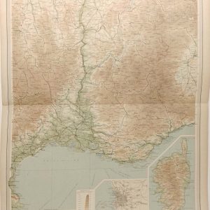
Antique map showing the Riviera, Gibraltar, Heligoland, Andorra and the Balearic Islands. There is a map showing French & Italian islands on the reverse.
1 in stock
Antique map showing the Riviera, Gibraltar, Heligoland, Andorra and the Balearic Islands. There is a map showing French & Italian islands on the reverse.
The map was originally published by W & A K Johnson in Edinburgh as part of the World Wide Atlas.
The map is in very good condition, paper shows ageing and bumping at edges.
Good margins for framing.
The maps are 10 by 8 inches with the overall outer dimensions being 10 by 12 inches.
Additional information
| Weight | 0.1 kg |
|---|
You Might Also Like
-

Brittany Spaniel 1938 Vintage Print
€34.95 Add to cart -
France South Eastern Section Antique Map 1922
€29.95 Add to cart -
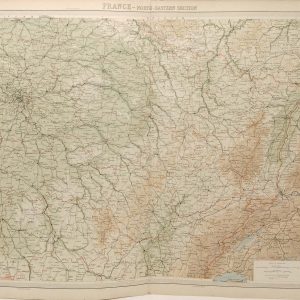
France North Eastern Section Antique Map 1922
€29.95 Add to cart -

Barbet 1938 Vintage Print
€34.95 Add to cart -

Pont-Audemer Spaniel 1938 Vintage Print
€34.95 Add to cart -
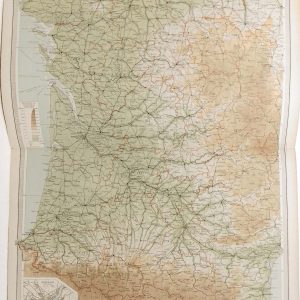
France South Western Antique Map 1922
€29.95 Add to cart -
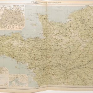
France North Western Section Antique Map 1922
€29.95 Add to cart -

French Spaniel 1938 Vintage Print
€34.95 Add to cart -

Gordon Setter 1938 Vintage Print
€34.95 In your cart -

Picardy Spaniel 1938 Vintage Print
€34.95 Add to cart