Ireland County Maps
County maps from across Ireland from the 19th and early 20th century.
Showing 1–35 of 63 results
-
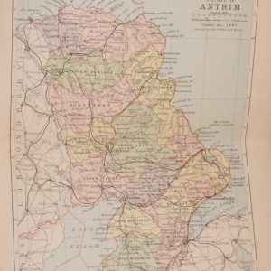
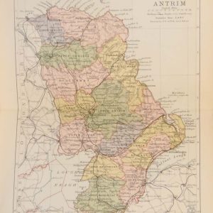
1881 Antique Colour Map of The County of Antrim
€39.00 Add to cart -
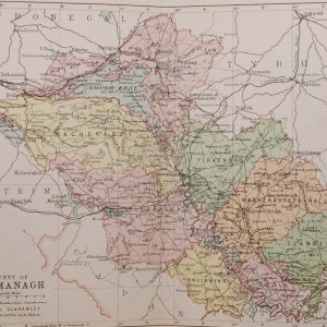
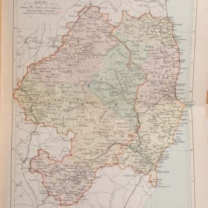
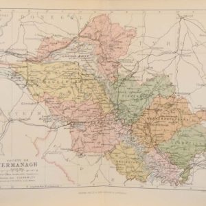
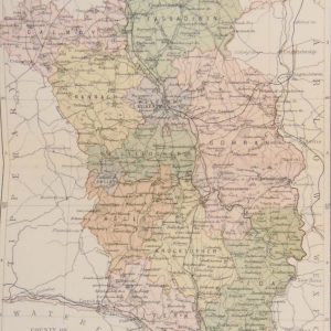
1881 Antique Colour Map of The County of Fermanagh
€39.00 Add to cart -
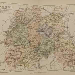
1881 Antique Colour Map of The County of Laois
€39.00 Add to cart -
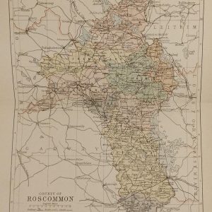
1881 Antique Colour Map of The County of Roscommon
€39.00 Add to cart -
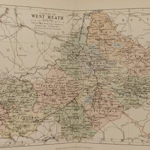
1881 Antique Colour Map of The County of Westmeath
€39.00 Add to cart -
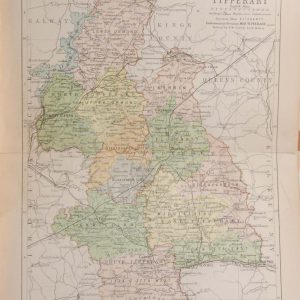
1890 Antique Colour Map of The County of Tipperary
€39.00 Add to cart -
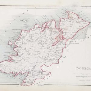
Antique Colour Map of Donegal circa 1840’s
€39.00 In your cart -
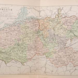
Antique Colour Map of The County of Limerick
€39.00 Add to cart -
Antique Colour Map of The County of Wicklow
€39.00 Add to cart -
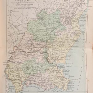
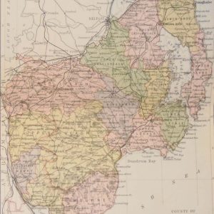
Antique Colour Map of The County of Wexford
€39.00 Add to cart -
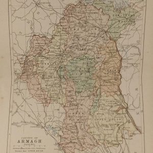
1881 Antique Colour Map of The County of Armagh
€39.00 Add to cart -
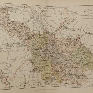
1881 Antique Colour Map of The County of Cavan
€39.00 Add to cart -
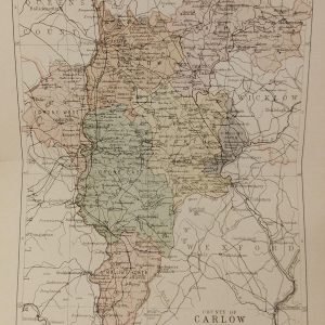
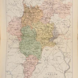
1881 Antique Colour Map of The County of Carlow
€39.00 Add to cart -
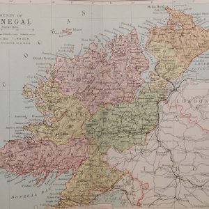
1881 Antique Colour Map of The County of Donegal
€39.00 Add to cart -
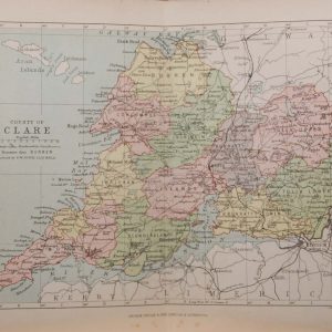
1881 Antique Colour Map of The County of Clare
€39.00 Add to cart -
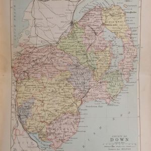
1881 Antique Colour Map of The County of Down
€39.00 Add to cart -
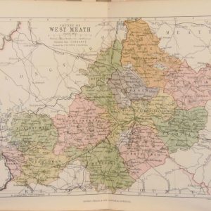
1884 Antique Colour Map of The County of Westmeath
€39.00 Add to cart -
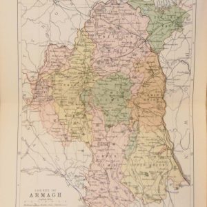
1884 Antique Colour Map of The County of Armagh
€39.00 Add to cart -
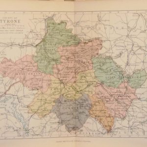
1884 Antique Colour Map of The County of Tyrone
€39.00 Add to cart -
1884 Antique Colour Map of The County of Antrim
€39.00 Add to cart -
1884 Antique Colour Map of The County of Carlow
€39.00 Add to cart -
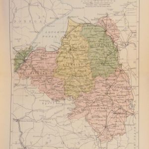
1884 Antique Colour Map of The County of Fermanagh
€39.00 Add to cart -
1884 Antique Colour Map of The County of Derry
€39.00 Add to cart -
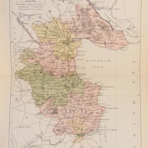
1884 Antique Colour Map of The County of Louth
€39.00 Add to cart -
1884 Antique Colour Map of The County of Kilkenny
€39.00 Add to cart -
1884 Antique Colour Map of The County of Down
€39.00 Add to cart -
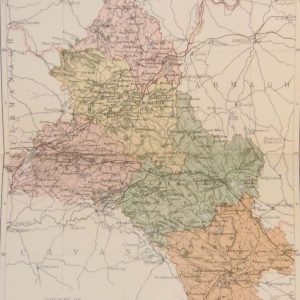
1884 Antique Colour Map of The County of Monaghan
€39.00 Add to cart -
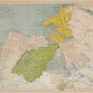
1884 Antique Colour Map of The County of Sligo
€39.00 Add to cart -
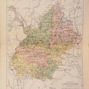
1884 Antique Colour Map of The County of Longford
€39.00 Add to cart -
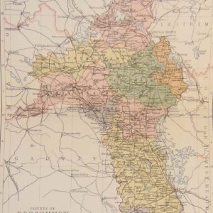
1884 Antique Colour Map of The County of Roscommon
€39.00 Add to cart -
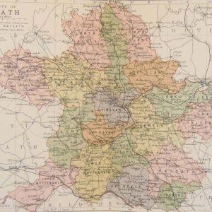
1884 Antique Colour Map of The County of Meath
€39.00 Add to cart -
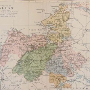
County Sligo 1902 Antique Map
€35.00 Add to cart -
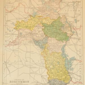
County Roscommon 1902 Antique Map
€35.00 Add to cart -
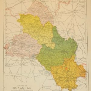
County Monaghan 1902 Antique Map
€35.00 Add to cart -
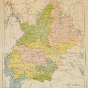
County Longford 1902 Antique Map
€35.00 Add to cart