")
")
")
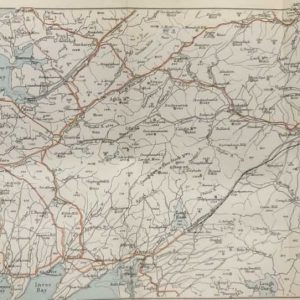
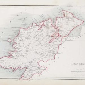
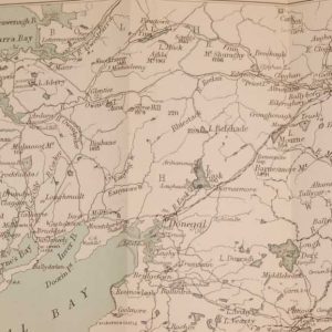
1881 Antique Colour Map of The County of Donegal
€39.00
1881 Antique Colour Map of The County of Donegal printed by George Philips, with the map constructed by John Bartholomew and edited by P. W. Joyce.
1 in stock
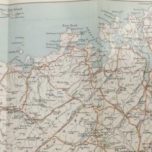
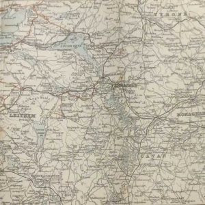
Antique colour map of the County of Donegal, printed in 1881.
The map has been printed on paper and was released as a fold out map.
It was printed in 1881 by George Philips in London with the map constructed by John Bartholomew and edited by P. W. Joyce.
Condition wise the map is in very good condition for it’s age, it is a fold out map so fold line is present, paper will show ageing, paper split at fold not affecting map area, please see pictures.
The map is 8 by 6 inches.
Additional information
| Weight | 0.2 kg |
|---|
You Might Also Like
-
Antique map Donegal South Section 1887
€29.00 In your cart -
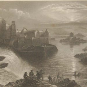
Ballyshannon Donegal 1841 Antique Print
€45.00 Add to cart -
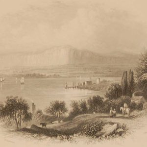
Lough Foyle 1850 Antique Print
€39.00 Add to cart -
Donegal Antique Map Including Baronies
€39.00 Add to cart -
Antique map Donegal North West Section 1887
€29.00 Add to cart -
Antique map of Belfast to Sligo 1887
€29.00 Add to cart -
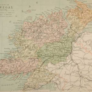
Antique Colour Map of Donegal circa 1840’s
€39.00 Add to cart -
Donegal Castle circa 1840
€39.00 Add to cart -
1878 Antique Colour Map of South Donegal Ireland
€25.00 Add to cart -
Ballyshannon County Donegal Antique Print
€19.95 Add to cart